
Forecast updated on Tuesday, July 25, 2023, at 4:00 PM by WBOC Meteorologist Dan Satterfield (AMS-CBM).
SYNOPSIS: A Severe Thunderstorm Watch is in effect for the evening and some heavy storms will pass across the area. The week ahead will feel like summer with temps. reaching the mid 90's by Thursday and Friday. The heat will linger through Saturday before a cool front brings temperatures down to the 80's by Sunday and Monday. This heat will be widespread from Manhattan to Texas.
DELMARVA FORECAST
Tonight: Evening storms around and some will be strong with heavy rainfall. Rain chances at 70% for any one spot. Fair skies late. Low 68-69° Wind: SW 2-7 mph.
Wednesday: Sunny, humid, and warmer. High 90° inland and 86° on the beaches. A weak PM sea breeze will drop coastal temps. to 82° later in the day. Wind: S 1-3 mph. Winds on the coast will be S/SE at 6-10 mph PM.
Wednesday Night: Fair and muggy. Low 74° Wind: S 2-7 mph.
Thursday: Sunny, humid, and hotter. High 94° inland and 89° on the beaches. A weak PM sea breeze will drop coastal temps. to 84° later in the day. Isolated showers about in the evening. Rain chances 10%. Wind: SW 11-23 mph.
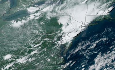
Forecast Discussion:
Evening storms will rumble across the area this evening as an upper-level trough passes through the area. Some cells may be strong or severe, with a damaging wind gust or hail. Skies will clear later tonight and it will turn muggy with light winds. Look for temperatures to dip to the upper 60's by daybreak.
Wednesday looks warm and sunny with PM temps. near 90 degrees. Winds will stay light from the south, but a sea breeze will cool the beaches back to the low 80's by mid-afternoon. An upper-level high pressure ridge will begin building over the region Wednesday and bring us some quite hot weather by Thursday/Friday.
Thursday will be sunny and hotter as a high-pressure system aloft builds over the entire region. Look for PM temps. near 90 degrees. Winds will increase from the south, with winds on the coast and inland at 12-24 mph by afternoon. A coastal sea breeze will cool the beaches back to the low to mid 80's in the afternoon hours.
In the long range: Friday through Saturday will be sunny and quite hot with high temps. from 96° Friday and 95° Saturday. Some thunderstorms will develop Saturday evening ahead of a cool front, and it will not be quite as hot Sunday and Monday with temps. dropping back to the mid 80's Sunday and Monday. Heat index values will be well over 100° later this week.
The average low for mid-July is 69°, with a high temp. of 87°. These are the highest averages for the entire year. Our normal high drops one degree today, beginning the slide into autumn.