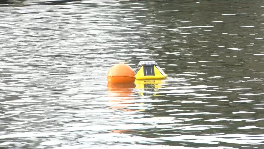
ST. MICHAELS, MD - A new tool to study rising sea levels is now bobbing on the waters of St. Michaels.
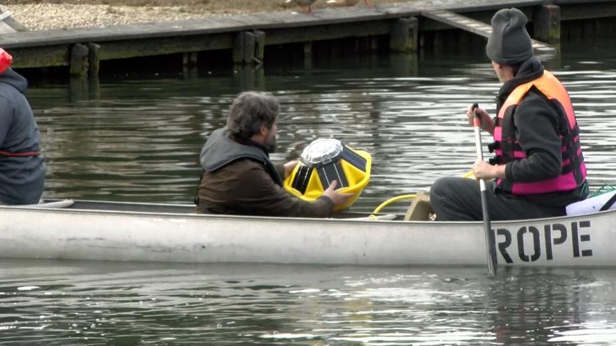
The smart buoy, equipped with a custom tide gauge sensor, is part of a proactive effort by town leaders to address frequent flooding. Andrew Thaler, a deep-sea ecologist and member of the St. Michaels Climate Change Commission, spearheaded the project.
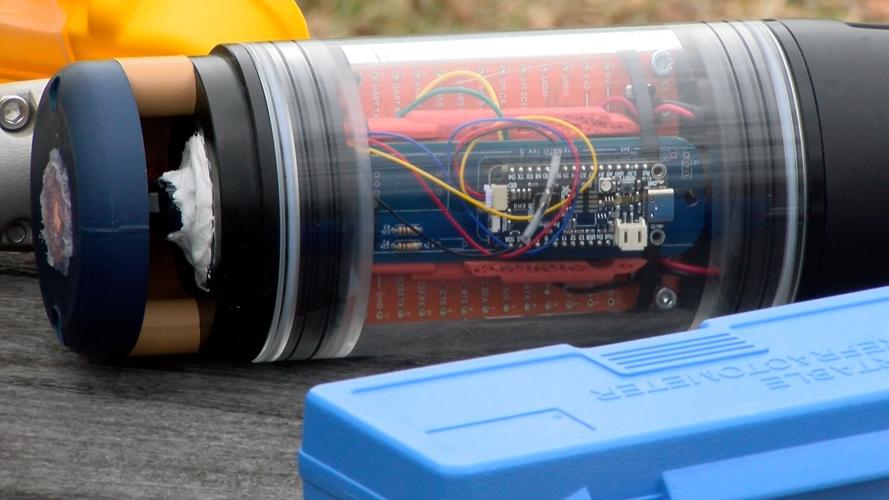
Thaler explained, the yellow buoy was donated to the town of St. Michaels by a company that makes smart buoys to provide ocean data. But he developed the other half of the tool. “I develop ocean sensors, and so with the town of St. Michaels, I have agreed to develop a tide gauge sensor for the base of our smart buoy. That will be measuring real-time flooding in town based on sea level height.”
St. Michaels often experiences nuisance flooding caused by high tides, and the town already has plans in place to address the issue.
“The town currently has proposals in to raise the road, Mill Street, and raise Honeymoon Bridge,” Thaler said. “When we have even moderate flooding, the pavement right behind you will be completely inundated.”
Sunday, the buoy was deployed in Honeymoon Lagoon, where it will remain for the next year. Thaler explained how the device works.
“It will measure the pressure of the weight of water on top of it,” he said. “We’ll take that measurement, combine it with the barometric pressure—so we’ll take away the atmospheric pressure—and then we can use that to figure out how high the water level is.”
The data collected by the buoy will be sent directly to Thaler’s phone, providing real-time updates on water levels.
“So having that data in town where we can see what is happening as it’s happening in real time is really important for making the right assessments about what we need to do to help make this town more resilient,” he said.
Thaler also explained, there is a 45 minute lag between the tide data stations in Annapolis, Cambridge, and Claiborne and when residents in St. Michaels experience flooding. "Because when we have a big rain storm we get the flooding first before it catches up with the tidal data," says Thaler
Thaler noted that flooding events not associated with storms are becoming more common, often occurring during regular high tides.
“We’re going to see those flooding events more and more frequently,” he said. “We really want to know how many times a year we expect to see those happening, and we can use that to project how many times we would expect to see them in 2030, 2040, or 2050.”
Thaler hopes to display the data collected by the buoy on the St. Michaels town website. Next year, he plans to move the buoy to a different location to collect additional data, continuing the town’s proactive approach to rising sea levels.

